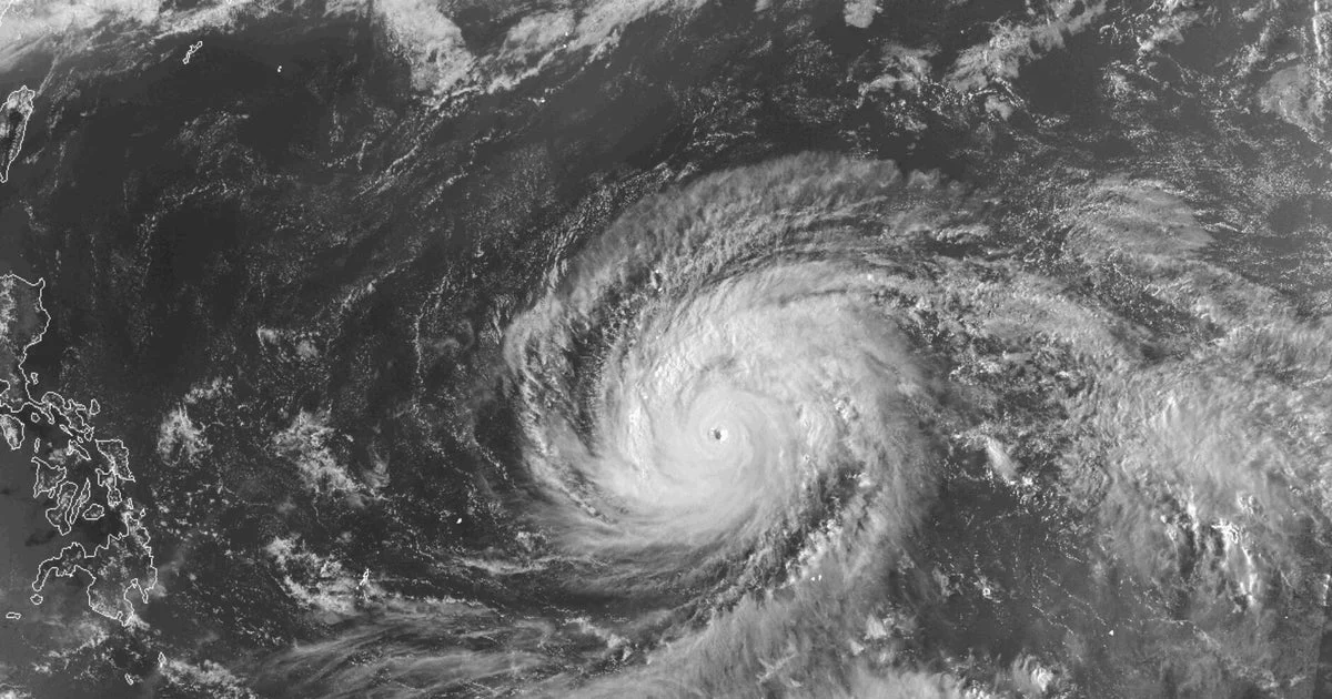
Typhoon Sinlaku, once a super typhoon and the strongest tropical cyclone of 2026, struck the Northern Mariana Islands with winds reaching 150 mph, delivering a severe blow to the U.S. territories in the western Pacific Ocean. The storm made landfall on the islands of Tinian and Saipan late Tuesday night local time, prompting widespread flooding, property damage, and emergency responses amid hazardous weather conditions.
At approximately 10:15 p.m. local time on April 14, the typhoon’s inner eyewall hit Tinian and Saipan as a Category 4 storm, featuring sustained winds of 150 mph. Shortly after landfall, Sinlaku weakened slightly to 145 mph and was downgraded from a super typhoon to a typhoon. Despite this reduction in intensity, the storm maintained dangerously high winds for several hours, with significant impacts reported across the islands.
Saipan’s mayor, Ramon “RB” Jose Blas Camacho, described the typhoon’s effects as severe, noting extensive flooding and the collapse of wooden and tin structures. The mayor indicated ongoing rescue efforts were complicated by the heavy rain and strong winds, which caused debris to fly around the island, endangering residents and responders. Video before the typhoon’s arrival showed the storm hovering offshore, unleashing intense winds and rain on Saipan.
The storm’s slow movement exacerbated concerns about prolonged exposure to destructive weather. For several hours, Sinlaku stalled roughly 30 miles off the coast of the Northern Marianas, increasing the duration of damaging conditions. Forecasters warned residents to prepare for extended periods of triple-digit wind speeds.
Nearby Guam, home to approximately 170,000 residents and three U.S. military bases, was not directly hit by the storm’s eyewall but still experienced tropical-storm-force winds and gusts up to 88 mph. Continuous strong winds persisted through Tuesday night and into Wednesday. Guam’s Joint Information Center urged residents to remain indoors, citing risks to public safety, infrastructure, and power lines. Schools were closed for at least two days, and widespread power outages were reported by Guam’s water authority.
Typhoon warnings remained active for the islands of Rota, Tinian, Saipan, Alamagan, Pagan, and Agrihan, while Guam stayed under a tropical storm warning and typhoon watch.
Sinlaku originated as a super typhoon with peak winds reaching 180 mph over the open Pacific before the eyewall replacement cycle—a process where a new eyewall forms and the original collapses—caused the storm to weaken slightly as it approached land.
Why it matters
Sinlaku’s landfall presents serious threats to the safety and infrastructure of the Northern Mariana Islands and Guam, emphasizing the vulnerabilities of remote island communities to intense tropical cyclones. Prolonged high winds and flooding disrupt emergency response and pose challenges for recovery. The storm’s impacts illustrate ongoing risks associated with Pacific typhoons affecting U.S. territories.
Background
In the western Pacific, typhoons with sustained winds above 150 mph are classified as super typhoons, equivalent to extreme hurricanes in the Atlantic. Sinlaku is the most powerful storm so far in 2026, surpassing earlier typhoons Narelle and Dudzai. Eyewall replacement cycles often lead to temporary weakening in such intense storms but can increase storm size and prolong hazardous conditions.
Read more World News stories on Goka World News.