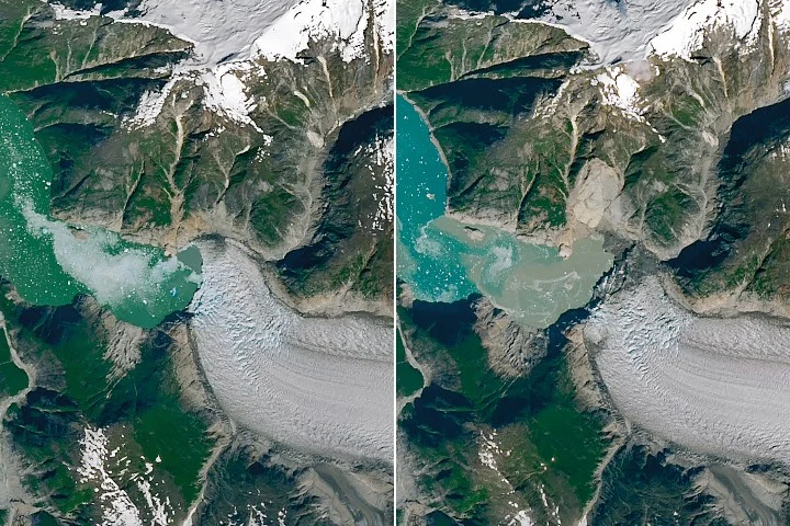
In August 2025, a massive landslide in southeast Alaska’s Tracy Arm fjord triggered a tsunami that swept vegetation from fjord shores as high as 1,578 feet (481 meters), dramatically altering the landscape in minutes. The slide involved at least 64 million cubic meters of rock tumbling into the fjord after the rapid retreat of South Sawyer Glacier.
NASA’s Earth Observatory released satellite images showing the fjord before and after the event, highlighting the bright scar on the north fjord wall from the landslide and a “bathtub ring” where the tsunami leveled forests. Even Sawyer Island, located approximately six miles (9 kilometers) from the landslide site, experienced significant vegetation loss, with only a few trees remaining at higher elevations.
Scientific Analysis and Observations
Researchers, including geomorphologist Dan Shugar from the University of Calgary, combined satellite data, airborne surveys, ground observations, eyewitness reports, and computer simulations to analyze the event. Their detailed study, published in the journal Science in May 2026, revealed that the water displaced by the landslide continued to oscillate in the fjord for over a day, a phenomenon called a “seiche.”
The event’s seismic signals were detected worldwide, with the landslide’s shaking equivalent to a magnitude 5.4 earthquake. The impact also caused a partial collapse of South Sawyer Glacier’s terminus, producing a slurry of icebergs in the fjord that contributed further to the dramatic transformation of the area.
Causes and Impacts
While the exact trigger for the landslide remains unclear, the rapid retreat of the glacier and geological destabilization likely played roles. Moderate rainfall prior to the slide may have contributed as well. The glacier’s retreat exposed new open water in a previously ice-covered area, increasing vulnerability to landslide and tsunami hazards.
No injuries were reported, but the tsunami caught some visitors by surprise. Kayakers camping on nearby Harbor Island lost gear to the waves, and passengers on a small cruise ship in the adjacent Endicott Arm experienced strong currents and fluctuations in water levels linked to the tsunami.
Why it matters
The Tracy Arm landslide-tsunami event illustrates the growing hazards in glacial fjord regions affected by warming climates and glacier retreat. The visible changes in glacier stability and rapid landscape shifts can serve as warning signs for increased landslide and tsunami risks. Given the popularity of fjord cruises in the area, understanding these natural threats is critical for public safety and tourism management.
Background
Tracy Arm is a glacial fjord carved over millennia by the movement and pressure of glacial ice. Its steep valley walls and dynamic ice fronts make it susceptible to sudden geological events. The retreat of glaciers worldwide is reshaping these landscapes, making previously stable areas vulnerable to landslides and other hazards. This 2025 event is among the largest such incidents recorded in the region in recent decades.
Sources
This article is based on reporting and publicly available information from the following source:
Read more Science Discoveries stories on Goka World News.