The National Oceanic and Atmospheric Administration (NOAA) has issued a warning that the forecasted El Niño event expected to develop this summer could contribute to frequent and widespread high tide flooding along U.S. coastlines in 2026.
El Niño, the warmer phase of the El Niño-Southern Oscillation (ENSO) cycle, influences atmospheric and oceanic conditions across the Pacific. NOAA’s Climate Prediction Center reported an 82% chance that El Niño will begin in July and persist through February in the Northern Hemisphere.
Dual factors driving increased flooding risk
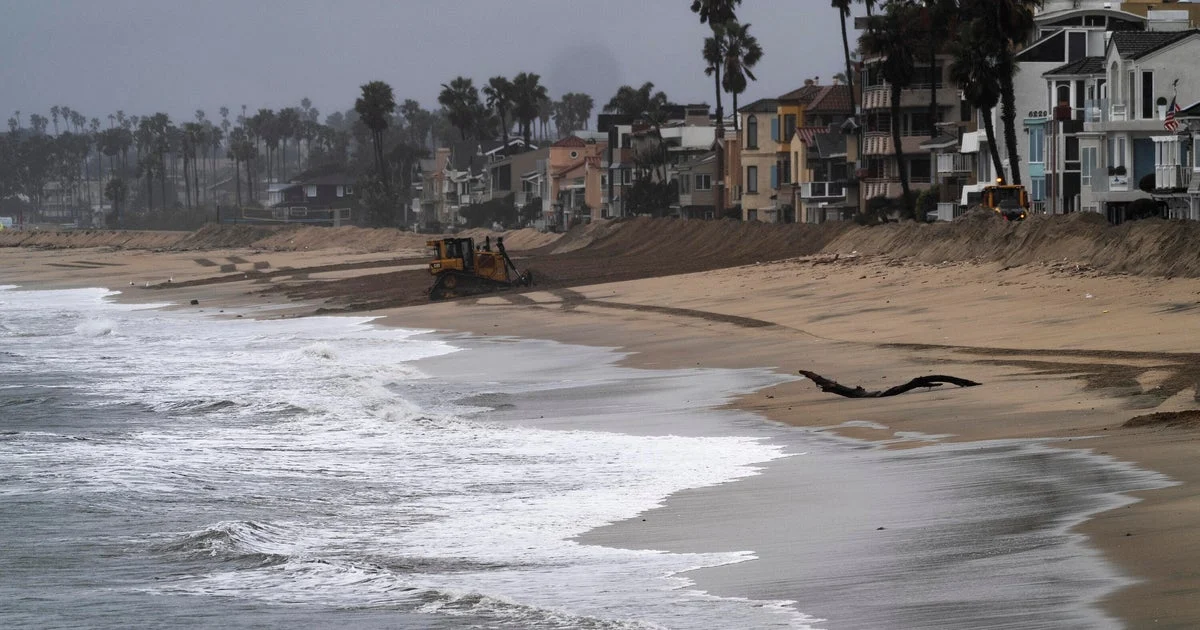
William Sweet, a NOAA oceanographer specializing in high tide flooding, explained that coastal areas are facing a “double whammy” from two converging factors. The first is the gradual rise in sea levels over recent decades, which has left waters near flood thresholds in many coastal communities. The second is the anticipated impact of a strong El Niño, which typically raises sea levels and intensifies high tides along both the West and East Coasts.
El Niño events weaken trade winds across the tropical Pacific, leading to ocean warming and elevated sea levels around the Americas for several months. This process often results in higher tides and stronger surf along the U.S. West Coast, increased storm surge risks on the Atlantic coast, and heavier rainfall for the southeastern and Gulf regions.
Potential regional impacts and NOAA preparedness efforts
Recent strong El Niño episodes, notably those from 2015-2016 and 2023-2024, have already shown increases in high tide flooding incidents. NOAA continues to monitor these patterns closely to better understand and predict flooding risks.
NOAA advises coastal communities to stay informed by using its coastal inundation dashboard, which provides real-time water level data and forecasts. Additionally, monthly flooding outlooks are available to help officials and residents prepare for potential high tide flooding events.
Why it matters
The combination of long-term sea level rise and the arrival of a strong El Niño could cause more frequent, deeper, and more widespread flooding even without storm events. This poses increasing challenges for coastal infrastructure, ecosystems, and communities vulnerable to inundation. Early awareness and preparedness efforts supported by NOAA’s data tools are vital to mitigating impacts.
Background
El Niño is one phase of the ENSO cycle, which oscillates every two to seven years between warmer (El Niño) and cooler (La Niña) conditions in the tropical Pacific. These shifts have significant effects on global weather patterns, affecting precipitation, storms, and sea levels worldwide.
This year, the ENSO cycle transitioned from La Niña to neutral phases, with forecasters expecting the next El Niño phase to begin imminently. NOAA’s ongoing observations and forecasting are aimed at providing early warnings to minimize damage and disruption.
Sources
This article is based on reporting and publicly available information from the following source:
Read more Climate & Environment stories on Goka World News.