A new NASA-funded study reveals a significant shift in the forces shaping the U.S. landscape: natural wild disturbances such as wildfires and hurricanes are rising, while human-directed land changes like logging, construction, and agricultural expansion have decreased.
What happened
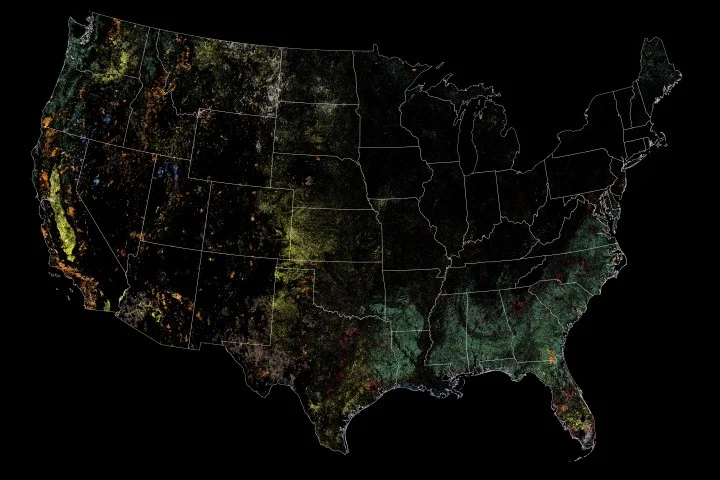
Scientists analyzed nearly 35 years of Landsat satellite data, spanning from 1988 to 2022, to evaluate patterns of land disturbance across the continental United States. The study found that 18 percent of U.S. land area experienced disturbance at least once during this period, totaling nearly 700,000 square miles when considering repeated impacts. Human activities accounted for more than half of the cumulative land change—over 446,000 square miles—while natural events such as wildfires, hurricanes, landslides, and drought-related stress disturbed more than 165,000 square miles.
However, the trend lines have diverged: human-caused land disturbance has decreased by about 232 square miles per year, attributable to reduced construction, agricultural expansion, and logging, influenced in part by policy shifts and economic factors like the 2008 financial crisis. Conversely, wild disturbances have increased by over 77 square miles annually, likely fueled by climate change and environmental stressors.
To differentiate the sources of land change, researchers developed a machine-learning algorithm trained on decades of satellite imagery and ground observations. This tool accurately classified disturbance types with over 75 percent accuracy, enabling a comprehensive analysis of landscape trends.
Why it matters
Understanding the increasing impact of wild disturbances is critical for future land management and disaster preparedness. As natural disasters become more frequent and intense, communities need informed strategies for resilience, such as prescribed burns, vegetation management, and fire-resistant construction materials. This research highlights a growing environmental challenge that requires adapting policies and practices from controlling disturbances to coexisting with them.
Background
Landsat satellites have provided continuous Earth observation data since the 1980s, making them invaluable for tracking landscape changes over time. Previous research established that human activity was the dominant force altering U.S. landscapes, but this new study shows a shift reflecting environmental changes and disaster trends. The study was published in the journal Nature Geoscience and led by former Landsat scientist Zhe Zhu. It reinforces NASA’s role in Earth science research that informs land use planning and environmental policy amid a changing climate.
Sources
This article is based on reporting and publicly available information from the following source:
Read more Climate & Environment stories on Goka World News.