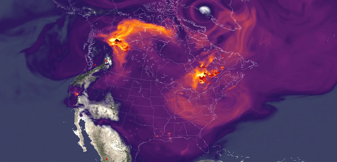
A recent NASA-supported study highlights how wildfire smoke has exacerbated ground-level ozone pollution across much of the United States, undermining progress made in air quality management over the last decade. This invisible but harmful form of pollution poses significant health risks far beyond the immediate vicinity of wildfires.
What Happened
Published on June 4 in the journal Science, the study found that wildfire emissions have increasingly contributed to unhealthy levels of ground-level ozone, commonly known as smog, throughout the contiguous U.S. After a period of ozone decline from 2003 to 2015, gains in air quality slowed or reversed in many areas due in large part to wildfires. The study quantified wildfire pollution as having erased nearly four years’ worth of national ozone-control progress, with even larger effects in the Western and Midwestern states.
Key Facts
- Wildfire smoke generates ozone-forming gases such as carbon monoxide, which react in sunlight to create surface ozone.
- Ozone exposure can irritate lungs and worsen respiratory conditions like asthma.
- The research team used deep learning to construct a daily, kilometer-scale ozone dataset spanning 2003 to 2024 across the U.S.
- Without wildfire influence, areas like the Midwest would have continued to see declines in ozone pollution after 2015.
- Wildfire-related ozone exposure contributed to an estimated 318 premature deaths annually nationwide post-2013, a 46% increase from the prior decade.
- Between 2022 and 2024, wildfires exposed an additional 43 million Americans to ozone levels exceeding federal air quality standards.
Why It Matters
Surface ozone is a critical public health concern because it can penetrate deep into the lungs, causing respiratory problems and exacerbating chronic disease, particularly in vulnerable populations such as children, the elderly, and outdoor workers. Understanding the scale of wildfire-driven ozone pollution informs air quality management, public health advisories, and policy decisions, especially as wildfire frequency and intensity increase under changing climate conditions.
Background
Ozone high in the atmosphere protects Earth from ultraviolet radiation, but near the surface, it is a harmful pollutant. While wildfires have long been recognized for particulate emissions, their role in elevating ozone levels is a more recent scientific focus. NASA satellites and ground monitors provide vital data to track and model air quality over vast regions, capturing pollution transport far from fire sources.
Analysis
The study combined NASA satellite data, ground-based air quality measurements, meteorological information, and atmospheric modeling using artificial intelligence techniques to isolate wildfire effects on ozone trends. This approach revealed that smoke plumes transported ozone precursors hundreds to thousands of miles across state lines, complicating air quality management. The findings shed light on the broad geographic impact of wildfire pollution beyond immediate fire zones.
Who Is Affected
The research indicates that millions of Americans, including those in states far from active wildfires, experience increased ozone exposure. The health burden particularly affects populations with respiratory vulnerabilities. Moreover, agricultural regions risk crop damage due to heightened ozone levels. The widespread nature of ozone pollution links distant wildfires with public health across large parts of the country.
Reactions / Official Statements
John Haynes, manager of NASA Earth Action’s Health and Air Quality program, emphasized NASA’s role in providing data crucial for air quality decisions as wildfire smoke affects communities across state boundaries. Jun Wang, lead author and atmospheric scientist at the University of Iowa, highlighted the regional transport of wildfire pollution and its implications for air quality management in areas like the Midwest.
What Remains Unclear
This information was not confirmed in the reviewed sources.
What Comes Next
Building on these findings, NASA’s ongoing missions, including the recently launched TEMPO satellite, will provide hourly air quality data with improved resolution to monitor pollution dynamics in near real-time. Wang’s team has developed FireAQ, a decision-support tool integrating satellite, model, and fire data to help local officials anticipate and manage smoke-related air quality risks during wildfire seasons.
Sources
This article is based on reporting and publicly available information from the following article-relevant source(s):
Read more Climate & Environment stories on Goka World News.