
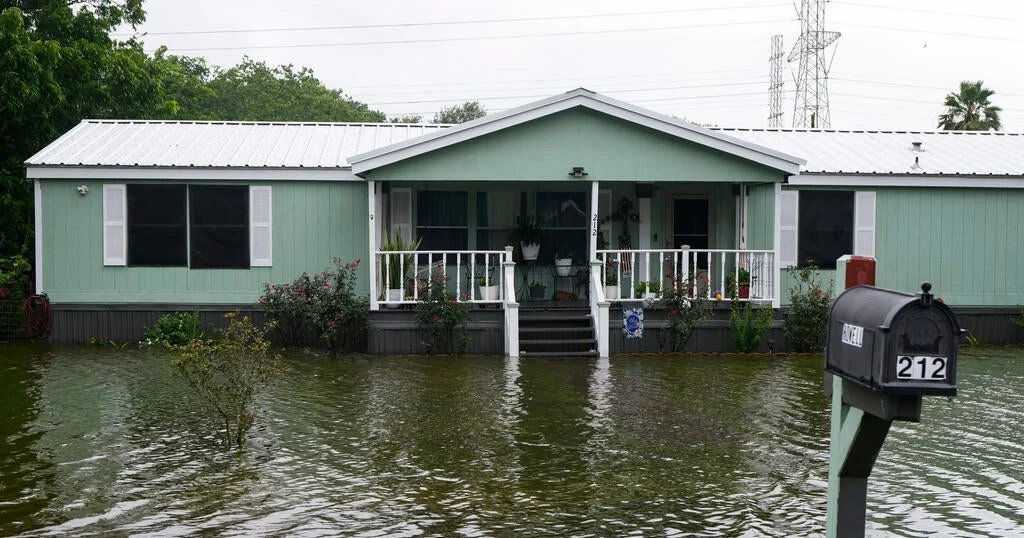
Tropical Storm Arthur formed off the Texas Gulf Coast and weakened after making landfall, though it still poses a serious threat of life-threatening flash flooding across parts of Texas and the southeastern United States. The National Weather Service cautioned residents to remain vigilant as the storm’s remnants continue to affect the region.
What Happened
Arthur developed near the middle of the Texas coast, less than 50 miles from Port O’Connor. It made landfall and later weakened below tropical storm strength, downgrading to a post-tropical cyclone. As of late Wednesday night, the storm was centered about 35 miles northeast of Galveston and 85 miles west-southwest of Lake Charles, Louisiana. Moving northeast at 9 mph, Arthur’s maximum sustained winds dropped to 35 mph, below the 39 mph threshold for tropical storm status and well beneath hurricane levels.
The remnants of Arthur are forecast to move further inland over southeastern Texas and western Louisiana, before crossing the southeastern U.S. Thursday and Friday. Despite weakening, the system is expected to bring widespread heavy rain and dangerous flash flooding over the coming days.
Key Facts
- Arthur formed in the western Gulf of Mexico earlier this week.
- Maximum sustained winds dropped to 35 mph after landfall.
- Flash flooding threats remain in Texas, Louisiana, Mississippi, Alabama, and the Florida Panhandle.
- Rainfall totals may reach 5 to 10 inches in impacted areas.
- Life-threatening surf and rip current conditions expected along the northwestern Gulf Coast for 1 to 2 days.
- There is potential for isolated tornadoes in the affected regions.
- The 2026 Atlantic hurricane season is predicted to be below-average, with 8 to 14 named storms and 3 to 5 hurricanes expected this season.
What This Means
Although Arthur weakened significantly after landfall, the storm’s lingering heavy rains and flooding threats highlight the continuing vulnerability of Gulf Coast and southeastern communities to tropical weather hazards early in the hurricane season. For residents, this means ongoing risks to property and safety from flash floods, hazardous surf, and potential tornadoes even when wind speeds are no longer at tropical storm force.
The storm underscores the importance of remaining prepared and closely monitoring official advisories during hurricane season, which, despite forecasts of below-average activity, can still produce localized severe impacts. Emergency management and local governments must continue coordinating flood response efforts and warning systems to protect residents in flood-prone and low-lying areas.
What Comes Next
The National Hurricane Center and local weather services will track Arthur’s remnants as it moves inland through southeastern states over the next few days. Residents in the warning zones are advised to follow updates on rainfall, flooding conditions, and severe weather risks.
Sources
This article is based on reporting and publicly available information from the following source:
Read more US News stories on Goka World News.