
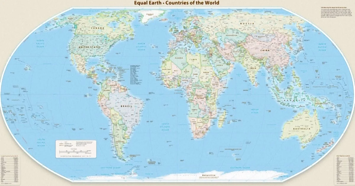
The United Nations General Assembly has officially endorsed a new world map projection that more accurately reflects the true size of Africa, marking a significant step in correcting long-standing cartographic distortions. The move comes after a campaign spearheaded by African countries and advocacy groups seeking to reshape global perceptions through better geographical representation.
What Happened
On September 4, 2026, the UN General Assembly passed a resolution sponsored by Togo and supported by the African Union encouraging the global adoption of the Equal Earth map projection. This map presents continents in their correct proportions, notably showing Africa as substantially larger than typically depicted on the traditional Mercator projection. The vote saw 164 member states in favor, with only the United States opposing, and six countries—Serbia, Estonia, Georgia, Lithuania, Moldova, and Ukraine—abstaining. While the resolution does not mandate replacing the Mercator map, it formally recommends that governments and institutions worldwide consider adopting the more accurate Equal Earth projection.
Key Facts
The Mercator projection, created in the 16th century by cartographer Gerardus Mercator to aid European naval navigation, notably exaggerates landmasses near the poles—making Greenland and North America appear disproportionately large—and shrinks equatorial regions such as Africa. In contrast, the Equal Earth projection, developed in 2018, maintains the Earth’s curvature and depicts continents in their true sizes. For instance, on the traditional Mercator map, Africa and Greenland look roughly the same size, though Africa is actually about 14 times larger. The resolution’s passage reflects widespread support from the African Union and key advocacy organizations, including Africa No Filter, which campaigns for greater accuracy in maps used in education, media, and digital platforms.
What This Means
The adoption of the Equal Earth map projection will help reshape global understanding by correcting a centuries-old misrepresentation that has influenced education and perceptions worldwide. Because maps are powerful tools that guide how societies conceptualize geography, adopting a more precise representation of Africa challenges biases and promotes a more equitable view of the continent’s size and significance. This shift could impact educational curricula, media portrayals, and public discourse, fostering a better appreciation for Africa’s geographical and cultural importance. Symbolically, it addresses the legacy of Eurocentric perspectives in cartography, marking a step toward decolonizing global knowledge systems.
For African nations, this endorsement enhances efforts to correct distortions that have long affected their global image. For the broader international community, it encourages reassessment of how geographic information shapes political, social, and economic narratives around the world.
Background
The Mercator projection, dating back to 1569, was designed to assist European navigators by preserving angles, but it distorts area, particularly enlarging regions near the poles. African leaders and advocacy groups have criticized this distortion for misrepresenting the continent’s true scale and influence. The Equal Earth projection emerged in 2018 as a more accurate alternative that preserves area and shape in a visually appealing, geographically truthful manner.
Reactions
Togo’s Foreign Minister Robert Dussey emphasized the power of maps, stating, “Maps shape our understanding of the world. They guide education, nourish the imagination, and influence collective perceptions.” France’s Foreign Minister Jean-Noël Barrot highlighted the significance of the change on social media, calling correcting the map “an act of truth,” even while acknowledging that “changing the map obviously doesn’t change the world.”
What Comes Next
Following the UN’s endorsement, proponents seek wider adoption by national governments, educational institutions, media outlets, and digital platforms globally. The resolution encourages these stakeholders to consider replacing the Mercator projection with the Equal Earth map in official publications and teaching materials, aiming for broader correction of geographic misunderstandings.
Sources
This article is based on reporting and publicly available information from the following source:
Read more World News stories on Goka World News.