NASA’s Jet Propulsion Laboratory (JPL) and the U.S. Geological Survey (USGS) have confirmed the presence of a topaz deposit in California’s Mojave Desert through airborne spectral sensing as part of an ongoing mineral mapping campaign. This finding supports the hunt for underlying porphyry copper, a crucial mineral resource, beneath the desert surface.
What Happened
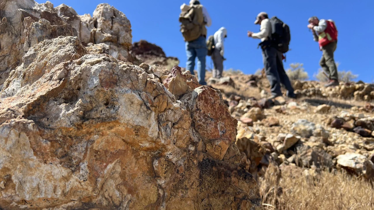
A team of geologists from USGS and NASA’s JPL conducted a field investigation near Barstow, California, after NASA’s AVIRIS-5 sensor detected a distinctive spectral “fingerprint” indicative of topaz. The airborne Airborne Visible Infrared Imaging Spectrometer (AVIRIS-5), built at JPL, was deployed on NASA’s ER-2 high-altitude aircraft during the NASA-USGS Geologic Earth Mapping Experiment (GEMx). Fieldwork involved collecting rock samples from the site to verify the sensor data on the ground.
Key Facts
- The AVIRIS-5 sensor measures reflected sunlight to identify minerals by their unique spectral signatures.
- The ER-2 aircraft collected data while flying at approximately 65,000 feet, completing 26 flights totaling over 125 hours between March 31 and June 5.
- The GEMx campaign has covered more than 386,000 square miles (1 million square kilometers) of the American West since 2023.
- Topaz is used as a surface indicator mineral that can hint at the presence of porphyry copper deposits formed in subduction zones.
- Porphyry copper is a global source of copper and related minerals like molybdenum and tellurium.
- The GEMx project is part of the USGS Earth Mapping Resources Initiative (Earth MRI) partnering with multiple stakeholders to modernize critical mineral exploration.
Why It Matters
This discovery demonstrates the power of combining advanced NASA airborne sensor data with targeted field geology to locate critical mineral resources important for steel manufacturing, solar technology, and electronics. Identifying porphyry copper deposits supports U.S. efforts to secure essential minerals for industry and technology in domestic sources.
Background
Previous mineral mapping efforts have relied heavily on airborne spectrometry to detect surface minerals like topaz that suggest more valuable mineral deposits below. NASA’s AVIRIS sensors have a heritage dating back to the 1980s and have been used on multiple planetary missions. The current GEMx survey extends this technology to extensive terrestrial mapping of critical minerals across the western United States.
Analysis
Erik Tharalson, USGS geologist, highlighted the significance of the finding in a historically well-prospected region, stating that “there’s a lot more to discover.” Robert Green of NASA JPL described their work as “geologic CSI,” combining sensor clues with field evidence to reconstruct subsurface mineralogy. NASA’s ER-2 project manager John McGrath emphasized how the aircraft’s high-altitude platform enables broad-area, high-resolution spectral data collection supporting Earth science research.
Who Is Affected
The findings directly impact geologists and mineral exploration efforts in the American West, supporting domestic mining and critical mineral supply chains relevant to manufacturing and clean energy sectors.
What Remains Unclear
- It has not yet been confirmed whether the topaz-bearing site overlies a porphyry copper deposit;
- Further ground-penetrating surveys and intensive subsurface investigations are required to determine mineral deposit scale and viability.
What Comes Next
The GEMx campaign will continue integrated airborne sensing and fieldwork across multiple western states. Intensive investigations using ground-penetrating equipment are planned to follow up on the Mojave topaz findings to assess the potential copper deposits beneath.
Sources
This article is based on reporting and publicly available information from the following source:
Read more Space & NASA stories on Goka World News.