
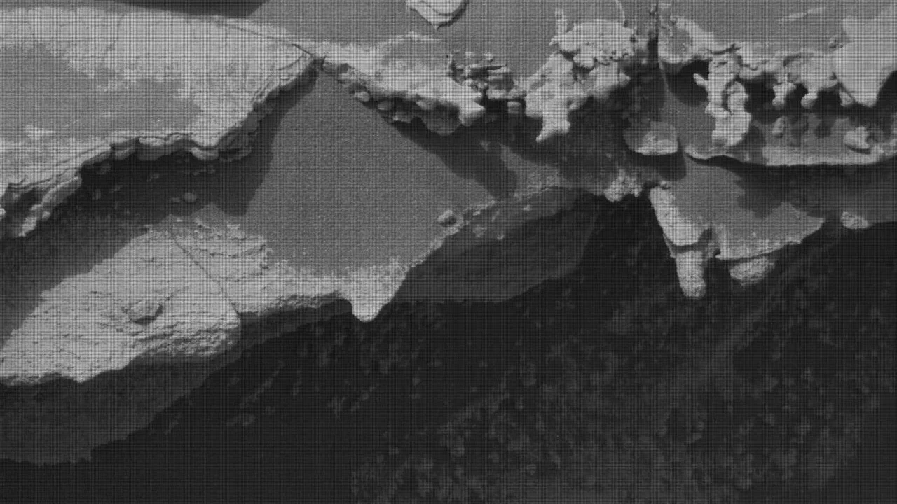
NASA’s Curiosity Mars rover resumed its journey climbing Mount Sharp this week after a brief scientific detour to examine unusual geological features above an erosional surface in Gale Crater. The mission team confirmed several rock analyses and conducted extensive atmospheric dust measurements as the rover transitions into Martian fall, when dust storm activity typically decreases.
What Happened
During sols 4982 to 4987 (Martian days), Curiosity paused to investigate distinctive bedrock formations near the erosional supersurface contact just above Gale Crater’s floor. The rover reacquired detailed images of the “Tres Morros” feature using its Mars Hand Lens Imager (MAHLI), enabling a precise study of its underside. The Alpha Particle X-Ray Spectrometer (APXS) measured bedrock targets “El Motacusal” after brushing and “Alto de Carmen” in their natural state, both documented with high-resolution MAHLI images. ChemCam performed laser-induced breakdown spectroscopy (LIBS) on rock targets “Lagunas Bravas” and “Parququcha,” along with remote micro-imaging of “Mishe Mokwa.”
Following these investigations, Curiosity drove approximately 100 feet (30 meters) to a safer science location. Due to the rover’s positioning, its robotic arm could not deploy drilling tools safely, but contact science continued with MAHLI and APXS observations of “Mamorecillo” and “Aguas Claras.” ChemCam targeted a resistant dark-toned bedrock layer named “Yura Kasa” for spectroscopic analysis. Mastcam captured several mosaics documenting the stratigraphy above the erosional surface.
Alongside science operations, Curiosity executed extensive environmental monitoring to detect dust in the atmosphere. Instruments such as Mastcam, APXS, and Navcam measured atmospheric optical depth (“tau”) and performed dust-devil surveys, sky observations, and cloud tracking to assess potential dust storm activity during this seasonal transition.
Key Facts
- Curiosity is operating on sols 4982 to 4987 within Gale Crater on Mars.
- The rover measured and imaged bedrock targets via MAHLI, APXS, and ChemCam instruments.
- Distinct geological targets include Tres Morros, El Motacusal, Alto de Carmen, Lagunas Bravas, Parququcha, Mishe Mokwa, Mamorecillo, Aguas Claras, and Yura Kasa.
- The rover drove approximately 100 feet (30 meters) between investigation sites.
- Mastcam mosaics document erosional ridges and stratigraphy.
- Environmental monitoring included optical depth and atmospheric dust measurements using Mastcam, APXS, and Navcam.
- Curiosity is preparing for a planned next drive of about 150 feet (47 meters) southwest, continuing Mount Sharp ascent.
What This Means
The return to systematic geological exploration marks an important phase in Curiosity’s mission, as it systematically maps the layered rock formations of Mount Sharp, aiming to unravel Mars’ ancient environmental conditions. The detailed imaging and chemistry of bedrock targets enhance understanding of past water activity and sedimentary processes, which are key to assessing Mars’ potential habitability.
Environmental dust monitoring informs scientists about current Martian atmospheric dynamics and helps ensure rover operations are safe and effective, particularly during seasonal transitions when dust storms may impact solar power and instrumentation. Confirming lower dust activity as fall advances improves mission planning reliability.
By continuing its steady climb, Curiosity provides vital ground-truth data complementing orbital observations, allowing researchers to build a detailed geological history of the planet’s surface and atmospheric evolution. This contributes broadly to planetary science and prepares the way for future crewed exploration.
Background
Curiosity has been exploring Gale Crater since its 2012 landing, conducting geological and climate studies to understand Mars’ habitability. Ascending Mount Sharp—a central mountain with extensive layered deposits—is a primary mission objective, as it carries a record of Mars’ changing environments.
What Comes Next
The mission team plans a drive of roughly 150 feet (47 meters) southwest to new stratigraphic outcrops, followed by further contact science and remote sensing investigations. Ongoing monitoring for dust storms will continue to guide operational decisions throughout Martian seasonal changes.
Sources
This article is based on reporting and publicly available information from the following sources:
Read more Space & NASA stories on Goka World News.