
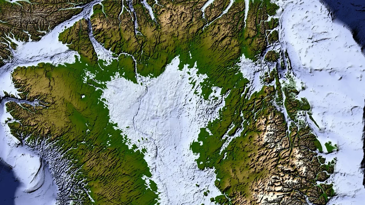
A NASA-led study has unveiled the most detailed map yet of the terrain beneath the Greenland Ice Sheet, revealing an expansive network of nearly 2,000 subglacial valleys previously unseen or only partially known. This new mapping exposes ancient geological features hidden beneath the ice, improving our understanding of both Greenland’s earth history and the dynamics controlling its ice sheet’s behavior.
What Happened
The breakthrough map was published in Geophysical Research Letters and produced using a technique called Ice Flow Perturbation Analysis. This method infers the shape of the landscape beneath the ice by analyzing subtle variations on the ice surface captured by satellites, which reflect the underlying topography’s influence on ice flow. Researchers manually identified 1,943 valleys beneath Greenland’s ice, about one-third of which are newly discovered, many extending farther inland than previous datasets indicated. The study also found extensive, interconnected valleys beneath previously uncharted regions.
Key Facts
Greenland’s ice sheet spans approximately 1.7 million square kilometers (656,000 square miles) and reaches thicknesses exceeding 3 kilometers (1.9 miles). The mapping effort updates and refines the BedMachine Greenland dataset, incorporating data on valley shapes, orientations, and extents using satellite measurements and ice flow analysis. The team identified distinctive valley networks originating in the southern and eastern highlands, where the ice sheet is believed to have formed, including a mountain range beneath the eastern ice containing alpine-style valleys.
Notable features include numerous long, straight valleys running southwest to northeast in the central-west region, likely shaped by tectonic forces, and wide branching angles indicating that groundwater, not just surface water erosion, contributed to valley formation prior to ice coverage.
What This Means
This map significantly advances understanding of Greenland’s hidden landscapes, which govern how ice moves across the bedrock and influences glacier behavior. Valleys act as natural channels that funnel ice flow, concentrating mass movement and accelerating ice loss where glaciers calve into the ocean. By revealing where these valleys extend—sometimes hundreds of kilometers further inland—the study provides vital data for predicting how the ice sheet will respond as it continues retreating.
Understanding the underlying topography is critical for modeling future sea-level rise, because faster ice flow through valleys means those pathways will remain key conduits for ice loss. The discovery of tectonically influenced valley alignments and groundwater erosion pathways also offers new insights into Greenland’s geological development before it became ice-covered, broadening knowledge of Arctic geology and climate history.
Background
The Greenland Ice Sheet, one of the largest ice masses on Earth, has increasingly come under scientific scrutiny due to its contributions to sea-level rise from melting and glacier calving. Previous efforts to map its bedrock topography have relied on multiple satellite and airborne measurements compiled into datasets such as BedMachine Greenland. However, many subglacial features remained incomplete or inaccurately represented, limiting predictions of ice flow and retreat.
Analysis
Joe MacGregor, a NASA cryospheric scientist and co-author of the study, highlighted the unexpected presence of aligned valleys indicating tectonic influence, challenging assumptions that Greenland’s bedrock is a rigid block. He also emphasized the role of groundwater in valley formation, a geological process less commonly considered in polar landscapes.
What Comes Next
The updated valley map provides an improved framework for integrating into ice flow and climate models, aiding scientists in refining projections of Greenland’s ice sheet changes over coming decades and beyond. Further analysis of satellite data and additional field campaigns may help resolve remaining questions about valley formation and the detailed relationship between bedrock features and ice dynamics.
Sources
This article is based on reporting and publicly available information from the following sources:
Read more Space & NASA stories on Goka World News.