
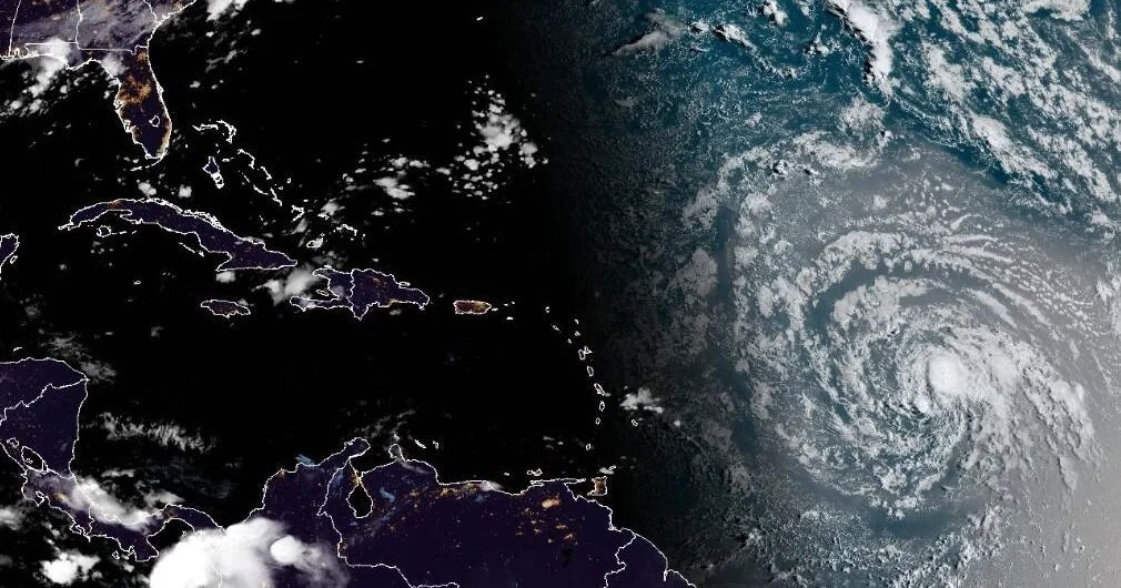
Tropical Storm Dolly, the fourth named storm of the 2026 Atlantic hurricane season, is advancing swiftly toward the Leeward Islands, raising concerns over heavy rainfall and localized flooding in U.S. territories including the Virgin Islands and Puerto Rico.
What Happened
As of the morning of August 28, 2026, the National Hurricane Center (NHC) reported that Tropical Storm Dolly was located more than 1,100 miles east of the Leeward Islands. It was moving westward at a speed of 24 miles per hour with maximum sustained winds reaching 24 mph. Though the storm may weaken into a tropical wave before reaching the islands, the NHC warned that significant rainfall could still occur. Heavy rains are expected to begin impacting the Leeward Islands late Saturday, extending into Sunday. The Virgin Islands, Puerto Rico, and Hispaniola could see rain starting Sunday through Monday, with flash flooding particularly possible in mountainous areas.
Key Facts
- Tropical Storm Dolly formed over the central Atlantic Ocean on August 27, 2026.
- The storm is moving west at 24 mph, with sustained winds of 24 mph, according to the Miami-based National Hurricane Center.
- Dolly is the fourth named storm of the 2026 Atlantic hurricane season, which typically runs from June through November.
- The storm’s heavy rains may cause flash flooding in higher elevations within the Leeward Islands territory.
- The 2026 season has been quieter than usual due to the influence of a strengthening El Niño in the Pacific Ocean.
- The World Meteorological Organization assigns storm names years in advance on an alphabetical list; “Dolly” coincidentally shares its name with the late country music icon, Dolly Parton.
What This Means
The approach of Tropical Storm Dolly serves as a reminder of the persistent threats posed by Atlantic storms to U.S. territories in the Caribbean, even in a season that has seen reduced hurricane activity. The expected heavy rainfall could disrupt daily life through flooding, particularly in vulnerable higher terrain, threatening infrastructure and transportation routes. Residents and authorities in the Leeward Islands, including U.S. territories, should prepare for potential emergency conditions such as flash floods and water damage.
Although Dolly may lose strength before landfall, its rainfall potential underscores the importance of weather vigilance in coastal and island regions. This episode highlights how tropical systems can evolve quickly and bring hazardous weather impacts even without hurricane-level winds. Monitoring local weather updates will be vital for individuals and emergency services navigating the ongoing storm season.
What Comes Next
The National Hurricane Center will continue tracking Tropical Storm Dolly’s trajectory and intensity throughout the weekend. Emergency management agencies in affected areas are likely to issue further advisories as more data becomes available. Residents should stay alert for official warnings and prepare accordingly for possible flash flooding and severe weather.
Sources
This article is based on reporting and publicly available information from the following source:
Read more Climate & Environment stories on Goka World News.